
: failed to open stream: Invalid argument in <b>/home/servuzmq/minisites/siteT1/common/template/carteV2.php</b> on line <b>139</b><br />
)
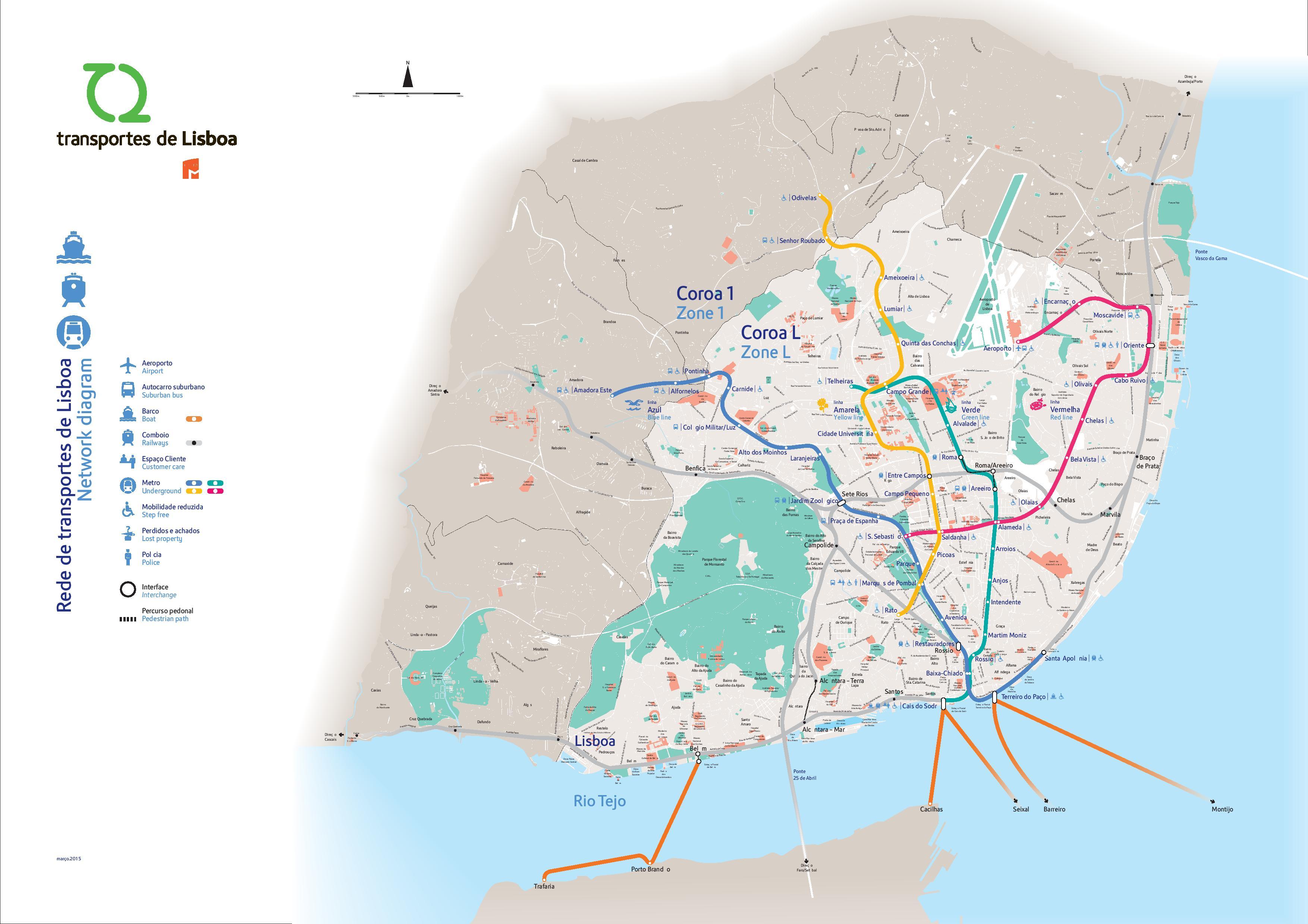
You can find on this page the Lisbon transport map to print and to download in PDF. The Lisbon transportation map presents the transports network and transport zones of the transit of Lisbon in Portugal.
The Lisbon transport map shows all means of transportation in Lisbon. This transports map of Lisbon will allow you to move easily with public transport of Lisbon in Portugal. The Lisbon transportation map is downloadable in PDF, printable and free.
Lisbon public transport network is extremely far-reaching and reliable and has its metro as its main artery, connecting the city centre with the upper and eastern districts, and now reaching the suburbs as its mentioned in Lisbon transport map. Ambitious expansion projects will increase the network by almost one third, connecting the airport, and the northern and western districts. Bus, funicular and tram services have been supplied by the Companhia de Carris de Ferro de Lisboa (Carris), for over a century.
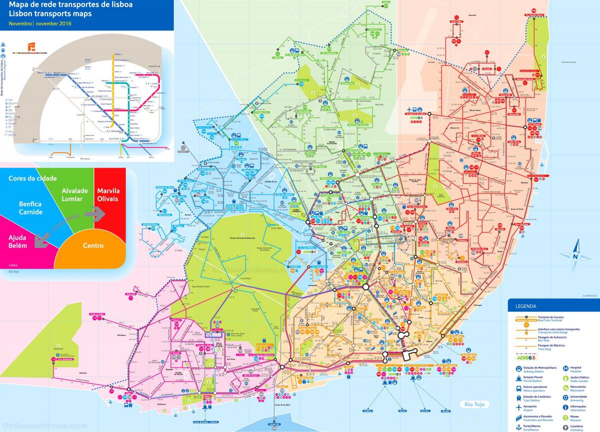
Lisbon has four main public transportations as you can see in Lisbon transport map: Bus (run by Carris, also includes trams, funiculars and the Santa Justa Elevator), Metro, Train (with CP and the private compnay Fertagus and ferries across the river. The Lisbon transport network works smoothly, although at times it could benefit from a higher frequency of service, it is relatively punctual.
Carris (Companhia de Carris de Ferro de Lisboa) is a public transportation company in Lisbon, Portugal (see Lisbon transport map). Carris operates Lisbon buses, trams, and funiculars. It does not operate the Lisbon Metro. Carris was founded September 18, 1872. A total of 234.4 million passenger boardings were recorded in 2008. As of Dec. 31, 2008, Carris employs 2,766 individuals, of whom 1,692 are bus drivers and 163 operate trams. The transport company operates 745 buses, 57 trams, 3 funiculars, and 1 elevator (the Santa Justa lift).
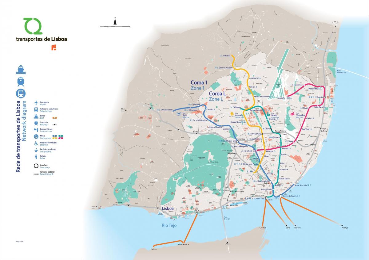
The Lisbon zone map shows all transport zones in Lisbon. This zone map of Lisbon will allow you to know the prices of public transport of Lisbon in Portugal. The Lisbon zones of transports map is downloadable in PDF, printable and free.
In Lisbon, there are different zones of the city when it comes to public transport. When you travel by public transport in the city, be aware if you need to go out from the city most central ring. "Coroa L" is the most central ring, including pretty much everything that you will want to see if you are in the city as a tourist as its shown in Lisbon zone map.
The price of the CP ticket or pass in Lisbon is calculated according to the number of zones you go through as its mentiond in Lisbon zone map. In the case of Lisbon stations that are on the borderline between zones, you only pay 1 zone for your ticket or pass, but you can only travel between these neighbouring stations. For a journey between Mercês and Rio de Mouro (neighbouring stations in different zones in Lisbon) you have to get a 1-zone ticket. If you want to use another station in the Mercês zone or the Rio de Mouro zone, you have to pay for two zones, but can then travel throughout the Sintra and Massamá-Barcarena zones.
When it comes specifically to the city of Lisbon bus system, there is a different ring zone map, but the most ring is equivalent to the one of the subway system as you can see in Lisbon zone map. A standard ticket or monthly pass will allow you to travel quite freely through all the central zones of the city of Lisbon, but if you need to travel in suburbs you might be required a different ticket for a higher fare.
