
: failed to open stream: Invalid argument in <b>/home/servuzmq/minisites/siteT1/common/template/carteV2.php</b> on line <b>139</b><br />
)
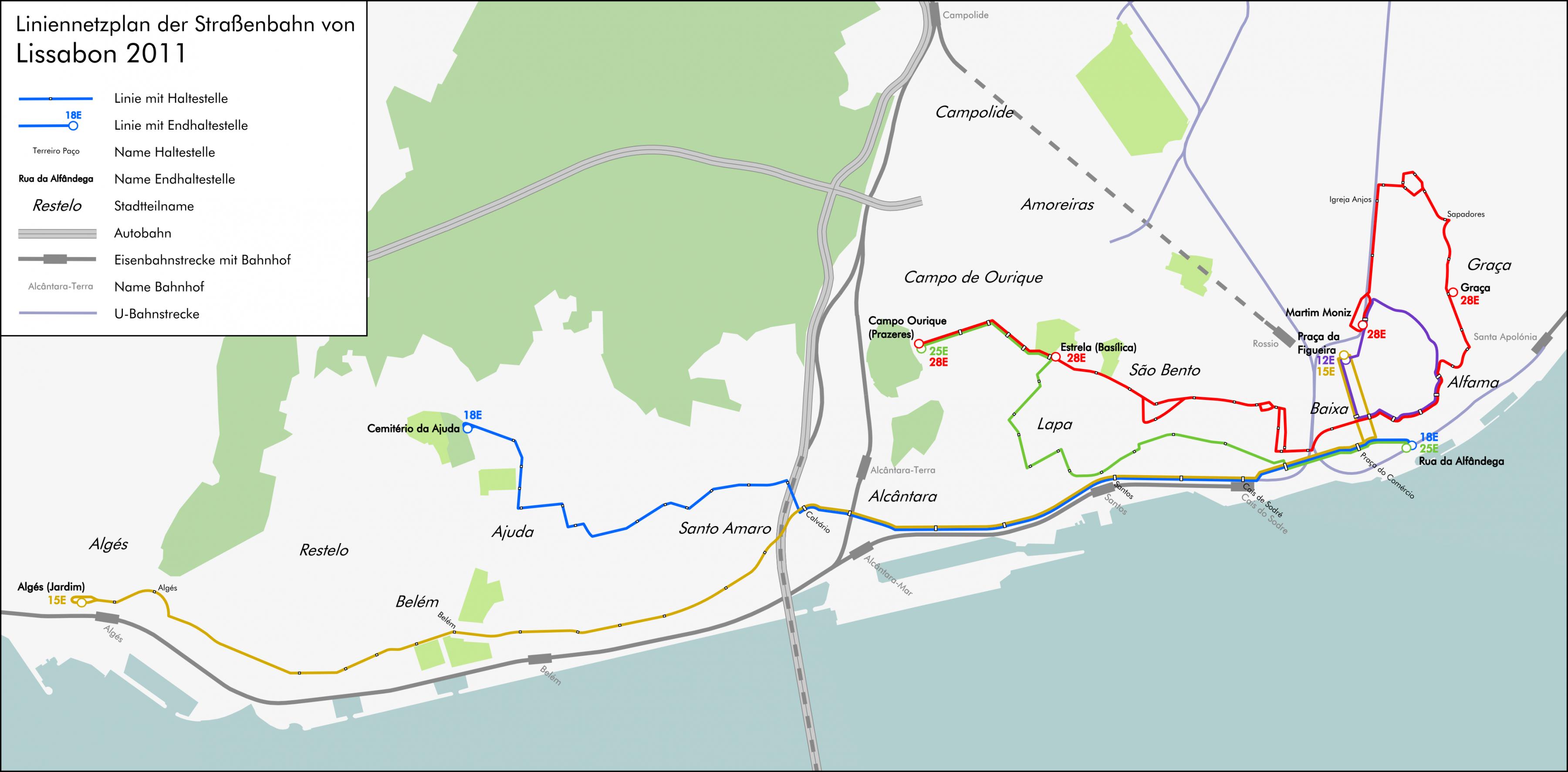
You can find on this page the Lisbon tram map to print and to download in PDF. The Lisbon trams map presents the network, zones, stations and different lines of the tramway of Lisbon in Portugal.
The Lisbon tram map shows all the stations and lines of the Lisbon tramways. This tramway map of Lisbon will allow you to easily plan your routes in the trams of Lisbon in Portugal. The Lisbon tram map is downloadable in PDF, printable and free.
The tramways in Lisbon are, not only one of the most useful means of transport to get around Lisbon, but also one of the city most popular tourist attractions. Portugal capital currently has five different routes and 58 tramways, of which 40 are vintage streetcars as its mentioned in Lisbon tramway map. The heritage trams are small, nostalgic and an emblematic symbol of Lisbon, making for great photos.
The nostalgic tramway 28 is an institution in itself. This wooden tramway will transport you to another era. Its horn rings constantly to warn absent-minded pedestrians to move out of the way when it runs past Lisbon long and narrow streets. The tramway links São Jorge Castle and Bairro Alto, crossing various picturesque neighbourhoods for 6.2 miles (10 km), including Graça, Mouraria, Alfama, Baixa, Chiado, Madragoa and Bairro Alto as you can see in Lisbon tramway map. Thousands of tourists take this tramway every day.
The tramway 15 is the most frequently used tramway in Lisbon because it connects the city centre and Belém as its shown in Lisbon tramway map. This tramway is not romantic. It is useful, modern and is always jam-packed with people, mostly tourists. If you take tramway 15, keep an eye on your belongings as there are pickpockets. The tramway 15 departs from “Cais de Sodré” station, a large interchange station near Praça do Comércio.