
: failed to open stream: Invalid argument in <b>/home/servuzmq/minisites/siteT1/common/template/carteV2.php</b> on line <b>139</b><br />
)
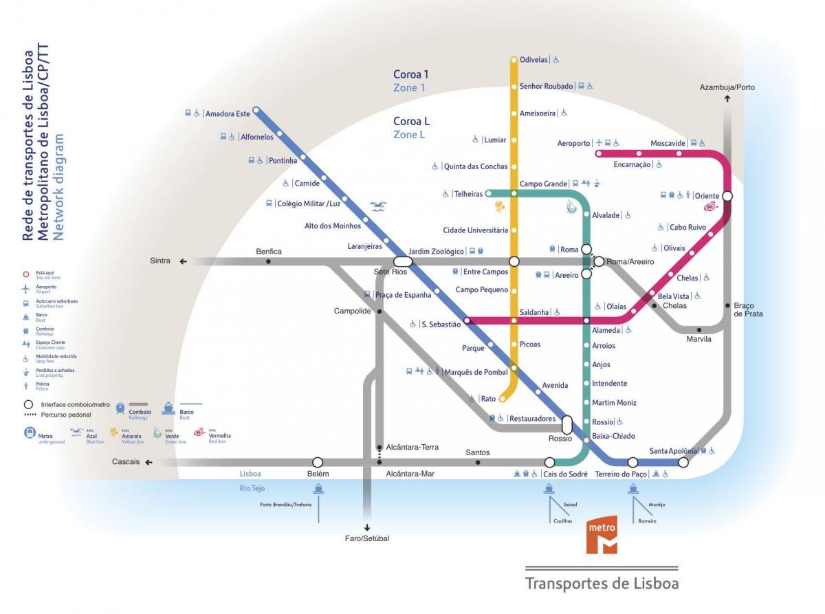
You can find on this page the Lisbon trains map to print and to download in PDF. The Lisbon trains map presents the rail network and railway stations of the trains of Lisbon in Portugal.
The Lisbon rails map shows all the railway stations and lines of Lisbon trains. This railway map of Lisbon will allow you to easily plan your route with the trains of Lisbon in Portugal. The Lisbon rails map is downloadable in PDF, printable and free.
The CP Urban Services network is the commuter rail network of Metropolitan Lisbon and Metropolitan Oporto, Portugal. It connects the city centers with the suburbs. The CP Urban Services in the great OPorto area consists of 4 main rail lines, linking Oporto Terminus São Bento Station (Estação de São Bento) in Oporto Downtown with the cities of Braga, Guimarães, Aveiro and Penafiel.
The Lisbon rail lines are completely electrified and the service is efficient. The Commuter rail service in Oporto is well connected with bus and metro service in the city, linking with lines A (Blue line), B (Red line), C (Green line) and E (Violet Line) of metro service in Campanhã Station and with line D (Yellow line) in São Bento Station as its mentioned in Lisbon rail map.
Since July 1999, a new rail link across the Ponte 25 de Abril (Tagus bridge) has been operated by FERTAGUS between Roma-Areeiro and Fogueteiro on the south bank with trains every 10-20 minutes as its shown in Lisbon rail map. On 6 October 2004, Fertagus extended the suburban railway service from Fogueteiro to Setúbal (hourly).
